Artificial Intelligence Response on Alert System. The advanced decision-support platform for managing extreme weather and hydrogeological events
AIRAS brings together bulletins, sensors, maps, and the territory's document archive into a single interface. Each response links back to the official document from which it originates.
It's not a black box. Every statement is linked to the original document, with the page number and source, and every area mentioned is linked to the map.
The memory of the territory
Emergency plans, procedures, ordinances, post-event reports, and hydrological records become a searchable database alongside real-time data from rain gauges, water level gauges, snow depth gauges, and webcams.
From Municipality to Region
One interface for the municipal area and one for the region, staffed by specialists in cartography, telemetry, and technical documentation.
Ongoing Projects
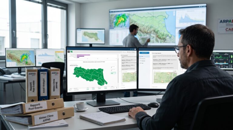
The trial with ARPAE and CAE
The first institutional implementation of AIRAS, developed in collaboration with CAE S.p.A. and launched with ARPAE Emilia-Romagna, the Regional Agency for Prevention, the Environment, and Energy. A dedicated instance, hosted on CINECA’s infrastructure, processes post-event reports from 2023 through July 2026, as well as hydrological annals and annual weather and climate reports. The operational phase will get into full swing with the start of the fall season.
Ex Machina is a strategic technology partner of REG4IA (Regions for Artificial Intelligence), the national program of the Department for Digital Transformation, within the hub focused on territorial resilience and security. In Emilia-Romagna, the project begins with a real-time simulation of the Lamone River’s levee routes—developed following the May 2023 flood—and extends it to the Senio River, which spans approximately 101 kilometers. The Group is developing a conversational agent that makes the results of the universities’ models accessible to those working in the region.
AIRAS WIR - The app that reports emergencies in your territory
With AIRAS WIR, an app available on the Apple App Store and Google Play Store, you can report floods, fires, landslides, tornadoes, snow, and ice in just a few seconds from your smartphone. You can attach up to 5 photos and your location, and the report is sent to the AIRAS system operators who manage weather emergencies.
Alert bulletins, forecasts, identified risk areas, uploaded documents, status indicators from rain gauges, snow gauges, and water level gauges, webcams, and contact information—all in a single view. The operational phase (none, caution, pre-alert, alert) is always highlighted.
The territory map
An expandable map displays high-risk areas, hazard levels, and locations, along with status indicators and system-generated content.
A conversation with the sources
Messages generated automatically, a multi-agent system tailored to the local area, and precise references to documents and map areas.
Documents that become knowledge
Post-event reports, ordinances, emergency plans, procedures, and unstructured documents: the system extracts the category, locations, date, keywords, and summary from them.
The territory interface
Bulletin, operational phase, map, content area, and chat—all on a single screen for the municipal operations center, with a direct link to the civil protection plan.
The regional interface
Statistics on uploaded documents, connected sensors, alerts extracted from the regional monitoring bulletin, and responses to ordinances with links to the sources.
With CINECA, on the Italian national computing infrastructure
Starting in 2024, the Ex Machina Group and CINECA, the interuniversity consortium for computer science, will collaborate on the AIRAS project under a three-year agreement. The instance dedicated to experimentation with ARPAE is hosted on CINECA’s high-performance computing (HPC) infrastructure at the Bologna Technopole.
In-depth information
AIRAS's direct collaborations with public entities, agencies, and civil protection organizations.
Request a customized AIRAS demo for your territory
Priority access for public entities, agencies, and civil protection structures
Manage Cookie Consent
To provide the best experiences, we use technologies like cookies to store and/or access device information. Consenting to these technologies will allow us to process data such as browsing behavior or unique IDs on this site. Not consenting or withdrawing consent, may adversely affect certain features and functions.
Functional
Always active
The technical storage or access is strictly necessary for the legitimate purpose of enabling the use of a specific service explicitly requested by the subscriber or user, or for the sole purpose of carrying out the transmission of a communication over an electronic communications network.
Preferenze
L'archiviazione tecnica o l'accesso sono necessari per lo scopo legittimo di memorizzare le preferenze che non sono richieste dall'abbonato o dall'utente.
Statistics
The technical storage or access that is used exclusively for statistical purposes.L'archiviazione tecnica o l'accesso che viene utilizzato esclusivamente per scopi statistici anonimi. Senza un mandato di comparizione, una conformità volontaria da parte del vostro Fornitore di Servizi Internet, o ulteriori registrazioni da parte di terzi, le informazioni memorizzate o recuperate per questo scopo da sole non possono di solito essere utilizzate per l'identificazione.
Marketing
The technical storage or access is required to create user profiles to send advertising, or to track the user on a website or across several websites for similar marketing purposes.